

Memorize Latitude Longitude
Memorize Latitude Longitude
Last updated 6/2020
MP4 | Video: h264, 1280x720 | Audio: AAC, 44.1 KHz
Language: English | Size: 1.98 GB | Duration: 1h 33m
Last updated 6/2020
MP4 | Video: h264, 1280x720 | Audio: AAC, 44.1 KHz
Language: English | Size: 1.98 GB | Duration: 1h 33m
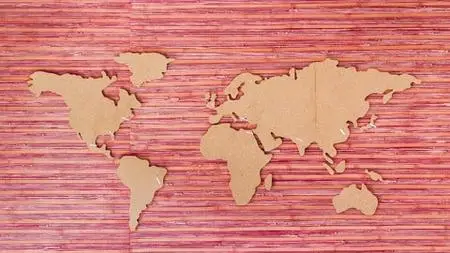
Learn to draw the World Map on the basis of Latitude & Longitude fairly accurately
What you'll learn
Learn to Accurately Draw the World Map using Latitudes & Longitudes.
Easy way to remember Latitude Longitude of the Entire World Map contour
Intuitively approach the boundaries of Countries in terms of Latitude & Longitude, so you can even memorize them, with a little effort
The Latitude & Longitude of important cities too are covered. Latitude gives you a way to guage the climate and Longitude gives you the time differences
Requirements
the student must be aware of the concept of Latitude & Longitude
it would be best if the student has already taken my Memorize World Map course
Students preparing for Civil Services exam and those who want to level up their knowledge of World Geography will find much help in this course.
Description
If you are a person who are not content with surface level information, this Course is for you. It is recommended that you get a hang of the World Map and the Continents & and Countries in some detail. We recommend you take my MEMORIZE WORLD MAP course where we show you how to draw the world map from memory including each and every country in its right place, all the 194 countries on it.You must also have some familiarity with how the Latitude & Longitude system divides the world map into a grid of coordinates and that helps in pinpointing any place in terms of these coordinates.In this course you will learn to draw the Continents accurately in terms of Latitude & Longitude. First we shall learn how to draw the Continents in terms of Blocks. Then we shall see the boundaries of these blocks as Latitude lines & Longitude lines in easy to remember numbers e.g. that Africa lies roughly between 30 degree North to 30 degree South latitude.Then we draw the World Map continents more accurately, and see the Lat Long coordinates more accurately, but still in terms of round figure numbers for easy reckoning.Thereafter, we go into each and every Continent and see their boundaries much more accurately, but still the borders are kept as straight lines for the most part, and their end points charted out. This immersion, will give you the feel of the lay of the land quite accurately.
Overview
Section 1: The Continents
Lecture 1 the Continents
Lecture 2 the Continent Blocks with Lat Long
Lecture 3 the Continents more Accurately
Section 2: the Individual Continents Accurately by Lat Long
Lecture 4 North America
Lecture 5 South America & Central America
Lecture 6 Africa
Lecture 7 Asia: Turkey to India
Lecture 8 Asia: India to Japan
Lecture 9 Europe
Lecture 10 Australia & New Zealand
Geography enthusiast,Civil service aspirants,Travellers interested to go deeper into the World Map