


Cartographica 1.2.3 (800) (Intel Only)
Cartographica 1.2.3 (800) (Intel Only) | Mac Os X | 47 MB
Cartographica is designed for people who need to work with geospatial data to create maps, analyze data, convert between formats, and discover new information about your data and the world in which it exists. As such, we have emphasized easy importation, exploration, analysis, and output in the design of Cartographica and hope that you find it powerful, yet fun to use and easy to explore.
Features
Cartographica if full of features to make it easy for your to explore, analyze and present your geospatial data. Here is just a sample of the facilities available in Cartographica. Features added or enhanced for 1.2 are marked with .
Flexible File Import
Cartographica has a wide range of data import capabilities, nearly assuring that you can turn your data into maps. Bring in your georeferenced raster data (like orthophotos and satellite imagery), your vector data from almost any source, or even CSV text files. A more complete list of imported and exported formats is available, including Personal Geodatabase.
Online Map Service Support
There's lots of good data available on the Internet. Getting data from a Web Map Server or Web Feature Server into your map document is a snap. Just load up the area you're looking to cover and select the Map Server. Cartographica will do the rest, from matching the coordinate system to testing the boundaries, to warping the graphics if necessary to meet your current CRS.
If you don't know where to start, just add a Live Map from Bing™ Maps or OpenStreetMap with one simple command.
Rapid Filtering
This is a Macintosh, and you'd expect fast filtering of data. With Cartographica, you get just that. Using the search box, you can filter on any column. With multi-variable searching and boolean operations you can explore your data even more effectively!
Sophisticated Layout
Cartographica provides sophisticated print layouts, including the ability to put multiple maps on the same page, overlay scale bars, compasses, and legends, or keep them aside, and add text notations. Even have multiple copies of the same map on a page with different zoom levels, extents, and visible layers.
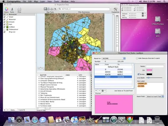
Flexible Styles
Styles define what layers should look like in a map. Easily put together a simple style based on fill and stroke colors, or create a sophisticated style set for a layer allowing easy identification of features with different attributes. Along with your colors, add labels for features, including data from any column or columns and on multiple lines if necessary.
Direct Editing
Need to define geometry for your map without exact coordinates? Cartographica lets you create a new feature, or edit an existing one with ease. Just double-click and move the control points. Styles and related information follow right along. Merge vector features into a single feature–consolidate roads or GPS tracks, join polygons.
Image Georeferencing
New for 1.2 is the ability to georeference (or edit the georeferencing information for) imagery. Georeferencing can be done with a standard matrix, or by adding or changing Ground Control Points (GCPs). And when you're just starting to georeference an image, you can use our Fit Display button as a first approximation. You can control transparency while you move the image around or warp it into place, so you can see just how things line up.
Undo Support
We believe that exploring geospatial data should be risk-free. Why should you have to live with every change you make? Cartographica's ubiquitous undo capabilities means whatever changes you've just made… you can undo them… and then put them back.
Layer Transparency
Take advantage of the sophisticated graphics you love on the Macintosh by using transparency to see through one level of data to the next. It is, of course, adjustable on a per-layer (or per-feature basis when you are using complex styles). You can even make a raster layer transparent (or any part of it), in order to enhance visibility of your crucial data.
Simultaneous Data/Map Browsing
Look at your data and map at the same time. Zoom in and filter the map and the data view follows. Scroll around and select features in the data set and they are hilighted on the map. Visualize your data your way. Don't want to give up screen space for the data view? That's fine, just drag it shut, and then open it when you need it again.
Geocoding
Got addresses? Cartographica is the easiest way to put them in their place. WIth Bing™ Geocoding support and our improved internal Geocoder, you have your choice of easy-to-configure online services, or geocoding using your own data (especially useful if you want to look at historical information). Cartographica will take addresses from lists in text files, tables in databases, or even your Macintosh Address Book.
GPS Support
If you need to load up field data from a variety of GPS devices, go no further than the File menu. Using the GPS import modules tested over the last three years in our free LoadMyTracks software, we can import waypoints, routes, and tracks directly from hundreds of devices, including those from: Garmin®, Magellan®, Lowrance®, Sony®, and others. And, if your device isn't directly supported, it can import the data using GPX files (the standard for GPS information).
Direct Database Access
Is your source data stored in a database? Cartographica can load data directly using ODBC (the standard for database exchange) and geocode it, join it to existing table data based on keys, or just import it as points with X and Y or latitude and longitude. No more multi-step processes and complex multi-program importing.
Intelligent Projection Management
There's a lot of data available out there, but often each layer is coded with a coordinate reference system that is specific to its producer's own needs. Cartographica understands that, but doesn't let that get in the way of making the data easy to use. Although you can change coordinate systems in existing layers, we'll be just as happy to do the conversions behind the scenes (for raster as well as vector data) in order to make sure your layers match up. And, if we don't have the projection or CRS built-in, you can add it yourself from another map or by importing a CRS in Proj4 or WKT format.
System Requirements
Intel Processor†
Mac OS X 10.6.2+ (Required)
512MB of RAM (1GB recommended)
1GB of Disk
Version 1.2.3 (800):
* This version is an enhancement and bug fix release that adds a number of small features and enhancements and addresses performance and functionality bugs in the existing 1.2.2 release. Please see below for a complete list of added features and changes.
This version is required for use with Lion (we discovered a bug when running under Lion with 1.2.2 that makes the Projection windows fail to show up).
Cartographica requires Mac OS X 10.6 (Snow Leopard)
If you need to use Cartographica under 10.5, please download an older version from the archives.
Known bugs/issues
o WFS access is read only. No changes are saved to the server.
o WFS client retrieves too much data in some queries.
New Features
o Added automatic export to CartoMobile for imagery
o Added support for exporting raster layers as tiles when they are displayed in EPSG:3857 (GE/BM/OSM)
o Added support for exporting data tables from layers
Enhanced Features
o Map now tries harder to remain in the same view when layers are reordered
o WFS configuration errors can now be corrected more easily by clicking on the warning triangle to bring up the edit window
o Image Georeferencing no longer requires explicitly selecting the image in a single-image raster layer
o KML Importer will now handle (incorrectly formatted) KML files with Schemas that are missing the required ID field.
o Speed enhancements when loading from GDAL-based importers
o Pasting vector data is now more intelligent and reliable, including the ability to reproject data on the fly when pasting into existing layers with different CRS
o Improve support for WFS 1.0 responses to WFS requests
o Resolved a number of edge-case scenarios with intersection and containment tests
o Added support for the ESRI alias "Double_Stereographic" for WKT standard "Oblique_Stereographic" in projection descriptions - Specifically important to older ESRI files used in New Brunswick
o Label positioning in polygons is improved
o Table and label formatting should now be the same for all labels (esp. number formatting)
o Export MIF/MID now allows character set selection
o Distances to nearest feature when inside of a polygon are now negative
o Better cache management in import and image libraries for increased performance on machines with greater RAM
o Exporting to image now uses multiple threads for warping
o Increased speed when loading raster files (especially very large rasters)
o Added better error handling and information to WFS Access
o Added more thorough checks for WFS servers to provide more information in failure cases
o Improved WFS Error handling and presentation with unusable URLs
o Default to using Bing Geocoder
UI Changes
o Make undo names more appropriate for some style transitions
o Edit Selected Feature is now Georeference Image or Georeference Selected Image when used on Raster layers
o Remove confusing default Server Name and URL from Add WMS Server prompt
o Undo/Redo of palette reversal maintains selection
o Tooltips in layer stack now show most recent errors (if known) for layers that have errors
o Tooltips in layer stack show information about each layer and the location of by-reference files
o Warnings now displayed for layers with fixable errors
o Rename zoom, identify,pan, and measure tools to be same as their menu counterparts
AppleScript changes
o Significantly increase performance for AppleScripts that access field data in Features
Bug Fixes
o Fixed bug which resulted in empty data fields when invalid characters in column names were used during GDAL export
o Fixed bug in handling drag-and-drop palette coloring when dragging to a single-style layer in the Style window with the option key held down (the stroke was never set)
o Fixed bug which could cause a crash when zooming and panning mapsets containing raster imagery when the Raster Georeference editor is active.
o Fixed bug which would cause an exception and no colors to be set if the palette you were dragging to a style had only one color
o Fixed bug which would cause an exception when dragging a zero-color palette to a style
o Fixed exception that could cause Raster image saves with bad source data to complete without noting an error
o Fixed exception that could cause a message to be logged if the minimum or maximum palette values were completely empty in the raster palette window
o Fixed potential crash in Layout window when a specified map doesn't finish loading prior to the Layout window being closed
o Fixed bug which could cause early termination of the buffering process if a NULL shape is encountered in the layer
o Fixed bug which would cause strange buffers to be created from lines that have duplicate points
o Fixed memory leak decoding ECW files with formatting issues
o Fixed small memory leak in image warping code
o Fixed bug that resulted in an empty map after importing via drag-and-drop or double-clicking on a non Mapset file until the window was resized
o Fixed bug which could cause WFS data from fields with names more than 13 characters to be ignored
o Fixed bug which could cause out of memory situations when loading a lot of tiles from OSM, Bing, or WFS servers
o Fixed bug which would cause WMS layers not to be correctly displayed if they are not available in WGS84 until after the first projection change or layer reorder
o Fixed a bug that would cause Personal Geodatabase importing not to work on machines that don't have certain libraries installed.
o Fixed a crash that would happen (or unexpected failure) when reading MDB (ESRI Personal Geodatabase) files
o Fixed bug which could cause a point that is on the line between two polygons to be counted in both polygons
o Fixed bug in nearest point distance to line that caused faulty results on multi-part lines when the distance between two line segments was closer than the distance from the segments themselves to the point.
o Fixed bug which resulted in stray white space having an effect on label positioning (or disappearing labels)
o Fixed crash when manually configuring Oblique Stereographic projections that would occur if not parameterized correctly (missing ellipse specification)
o Fixed bug in layer duplication which could cause child/parent relationship in the columns of duplicated layers to be incorrectly tied from the original layer to the duplicate layer (Mostly an AppleScript problem).
o Fixed bug where labels on polygons could appear outside of their polygons
o Fixed bug where full-path photos were not recognized correctly
o Fixed bug where layer output options were ignored when exporting multiple layers using a single-geometry only file format
o Fixed crash which would occur when field names were not understood reading Shape files
o Fixed handling of field names so that they're now conformant with ANSI instead of ASCII (acutally using CP1252).
o Fixed crashing bug when encountering corrupt .ov2 files on TomTom
o Fixed rare bug that could cause a crash when using server-based layers with local warping
o Fixed rare crashing bug which could occur when ending edit mode while drawing is happening in the background
o Fixed bug that prevented reading .VRT raster files (VRT vector files worked fine)
o Fixed significant memory leak when displaying raster data
o Fixed a faulty PDS error message
o Fixed rare crash that could be caused when pasting images into certain documents
o Fixed bug when using nearest distance to Polygon which would cause the "nearest" polygon to sometimes be an adjacent polygon which shared the same line as the containing polygon.
o Fixed missing localizations in Raster Image save code