

PROGOROD 1.2.2998 (31.08.2010)

PROGOROD 1.2.2998 (31.08.2010) | 1.60GB
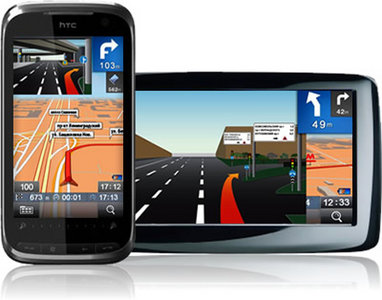
PROGOROD - a new navigation software for motorists, the main features of which include: support for Russian and English interface, interactive maps in the 2D projections, and 2,5 D, autoscaling maps in motion, the structure of relative storeys for the regime of 2,5 D, modes of the day and night (auto switching by time of day or self-tuning), the laying of tracks on the navigation map using different computational algorithms, and much more.
Year: 2010
Version: 1.2.2998
Developer: Sidique NAVIGATION
Platform: WM5, WM6, WinCE
Compatibility with Vista: No
Language: English and Russian
Medicine: Not required
System requirements:
* Windows Mobile 5.0, 6.0 and higher, PND WinCE (necessarily touch screen).
* From 64MB of RAM (depending on the scratch card).
* CPU from 300Mhz
* Supported screen resolution of 320x240, 240x320, 640x480, 480x640
* 480 * 272 for the PND (WinCE) 4,3 inch.
* 320 * 240 PND (WinCE) 3,5 inch.
* GPS-receiver is an internal or external
Now the program can be used without cracks:
The new version is organized to collect and send tracks to the server statistics program, we just have to periodically connect to the Internet, it will send the tracks and the server statistics and you can use the program indefinitely! If you have not bought a license, the function of the collection of tracks are not muted. If it connects to the Internet and sends the tracks from the program - demo mode is extended by the time he sends the tracks. If you send a regular basis (between the sending of not more than 5 days) - no annoying red reminders. When the program starts - automatic writing tracks movement (not to be confused with the recording of tracks from the menu). When you connect to the internet via GPRS or ActiveSync (via BB) accrued leave tracks on the server statistics.
The system of visual accompaniment for a given route:
* Specify the remaining distance to maneuver, as well as to the next for him maneuver
* Note the recommended lanes and maneuvering
* Instructions for highways and roundabouts
* Realistic image interchanges JunctionView ®, tips on complicated overpasses and intersections
* Specify number of rotation with the additional arrows
The system sounds for a given route:
* Voice prompts in real time
* Choice of different voices support
* Instructions for highways and roundabouts
* Notification of danger
How to Search:
* Quick Search. Available at any time from the main map screen. Search by address, points of interest POI, as well as metro stations without selection by region or locality
* Address search. Available from the menu or the Advanced Search from the main menu. Hierarchical search for addresses are given specific address Russian (housing, construction, ownership, etc.)
* Find points of interest POI at. Available from the menu or the Advanced Search from the main menu. You can select a category POI, or search for all categories / sub categories, followed by selection from the list of results. The search is performed within a radius of 3 kilometers from the target total (the house) or partial (only the city or street) address.
* Find points of interest POI near current position. The search is performed within a radius of 3 kilometers from the current position on the GPS.
* Find points of interest POI near the specified point on the map manually. The search is performed within a radius of 3 kilometers from the user-specified point on the map.
* Find points of interest POI near destination of this route. The search is performed within a radius of 3 kilometers from the finish point of the current route. This function is available only if the route marked.
* Find points of interest POI along a given route. The search is performed in the range of 300 meters along the road on a given route. This function is available only if the route marked.