

PCI Geomatica 2015
PCI Geomatica 2015 | 667.8 mb
PCI Geomatics, a world leading developer of remote sensing and photogrammetric software and systems, announced the release of its Geomatica 2015, is a powerful geospatial image processing software suite used by professionals, researchers and students around the world for fast and accurate image analysis and production.
Geomatica provides visualization tools, support for the latest satellite and aerial sensors, and over 550 algorithms to manipulate and extract information from imagery and related geospatial data. Geomatica provides powerful workflows for ortho/mosaic through OrthoEngine, and automation capability with our open source Python API, Easi and Modeler.
What's New in Geomatica 2015
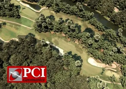
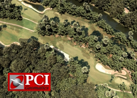
- Better Mosaics
In Geomatica 2015, new methods have been developed to produce a more accurate color balancing model that provides consistently pleasing results, with expanded manual tools for editing. Now, seamless mosaics can be produced regardless of seasonal anomalies, time-of-capture differences, or even differences in imaging sensors. Furthermore, interface improvements and overall workflow enhancements eliminate the need for post-mosaic editing in other software.
- Powerful Platform
Geomatica is a powerful and modular platform designed to exist at the core of your geospatial business. Hundreds of processing functions optimized for performance and accuracy are assembled and integrated to support image analysis, ortho-mosaic production, and workflow automation to generate intelligent business products, or customize your output for any number of market demands.
- Exposure Correction
In Geomatica 2015, you can decrease brightness on over-exposed pixels with to improve the visibility of lost details. Ideally suited to improve large mosaics as a post-processing step, this new algorithm was developed specifically to create better-looking images by giving you the control to adjust exposure variances in any image.
- New Sensors
Geomatica supports all major commercial sensors and many others as well. We work closely with data providers so you can rely on timely support for any new commercial platforms. Geomatica 2015 adds support for 30cm-resolution WorldView-3 (Optical) and Kompsat-5 (Synthetic Aperture Radar- SAR) among others.
About PCI Geomatics
PCI Geomatics is a world-leading developer of software and systems for remote sensing, imagery processing, and photogrammetry. With more than 30 years of experience in the geospatial industry, PCI is recognized globally for its excellence in providing software for accurately and rapidly processing satellite and aerial imagery. There are more than 30,000 PCI licenses, in over 150 countries worldwide.
Name: PCI Geomatica
Version: (64bit) 2015
Home: www.pcigeomatics.com.
Interface: english
OS: Windows XP / Vista / 7even / 8 / 8.1
Size: 667.8 mb